
Follow us on Linkedin
PUBLICATIONS
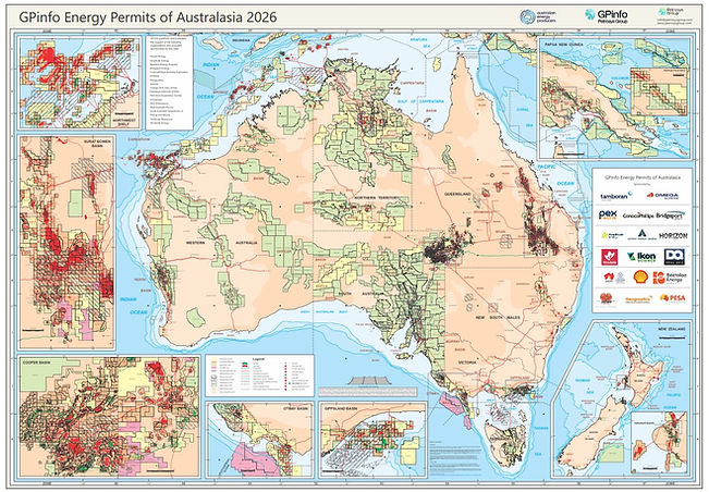
2026 Permits Map
Our permit map keeps the latest information available at your fingertips. Stay abreast of permit ownership information for Australia, Papua New Guinea, and New Zealand.
About the Permits Map
The GPinfo Energy Permits of Australasia Map is an attractive full-colour A0-sized wall map. Produced annually with industry support and assistance, it is the most accurate and up-to-date map of its kind and an essential tool for any company associated with the petroleum industry.
Maps show permit polygons, well locations, field outlines, and pipeline routes. There are detailed insets of areas of exploration interest at larger scale including the Northwest Shelf and the Cooper, Surat, Otway, Gippsland, Taranaki, and Papuan Basins.
Maps are available as matt vynal A0 wall map. An A3-sized version of the map is provided free of charge with every item purchased.
For information on sponsorship opportunities for the map, please contact info@gpinfo.com.au.

Copies of the GPinfo permit maps arrived this week and are already sprinkled around the office, including the boardroom and meeting rooms.
The maps provide an excellent reference to petroleum permit and pipeline locations for Australia, New Zealand, and Papua New Guinea and are of a quality that Bridgeport is proud to support.
Barry Smith, Chief Technical Officer,
Bridgeport Energy
Sponsor since 2013